
MPAS-Albany Land Ice (MALI): A Variable-Resolution Ice Sheet Model for Earth System Modeling Using Voronoi Grids
Image


Description
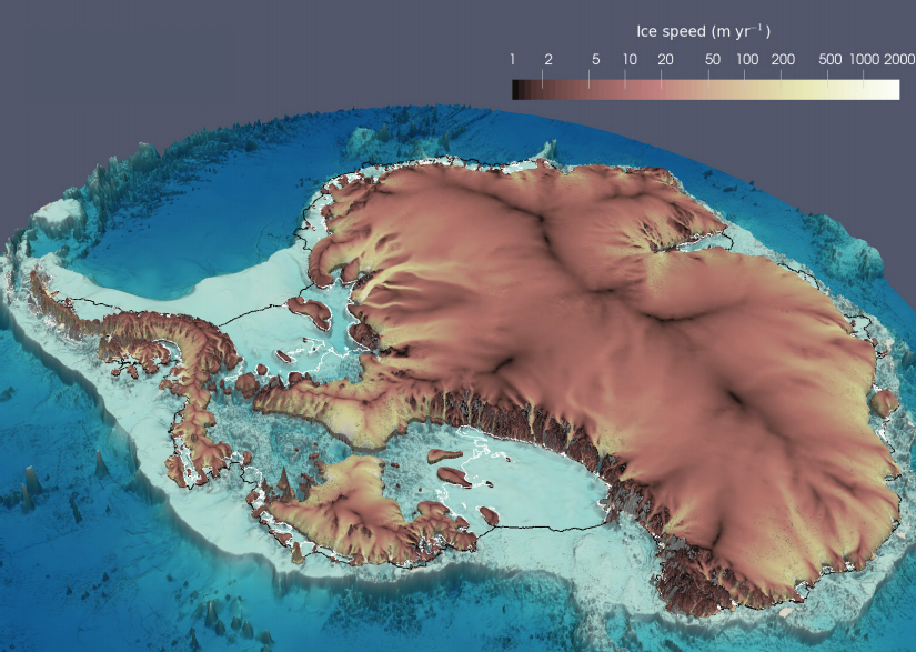
MPAS-Albany Land Ice (MALI) v6.0 is a new, high-fidelity, variable-resolution ice sheet model for use on high-performance computing architectures and for coupling to the U.S. Department of Energy’s new Energy Exascale Earth System Model (E3SM).
MALI is built using the Model for Prediction Across Scales (MPAS) framework for developing variable-resolution Earth system model components and the DOE multiphysics software library, Albany. MALI uses variable-resolution, unstructured Voronoi grids to provide high resolution only where needed such as in highly dynamic regions like ice streams and ice shelves, thereby applying computational power more efficiently.
Point of Contact
Matt Hoffman
Institution(s)
Los Alamos National Laboratory (LANL)
Download Software
Funding Program Area(s)
Project(s)