
Daymet v4 - High-Resolution, Multi-Decadal Surface Weather Dataset for Land Process Prediction Over North America, with Uncertainty Quantification
A 40-year record of daily surface weather data on a 1km grid over all of North America was developed using estimation methods based on sparse weather station observations and topography. Biases due to instrumentation changes and variable time-of-observation were identified and corrected. A detailed uncertainty quantification was performed. Both data and uncertainty information are served from a permanent archive with multiple tools designed for convenient user access.
The combination of high spatial resolution, multi-decadal period of record, improved ability to capture extreme events, and comprehensive uncertainty quantification makes Daymet v4 a best-in-class methodology and data product for Earth system model applications. This new method and the resulting data enable continental-scale high-resolution land model simulations, which will be used to evaluate biases in coupled model simulations at lower spatial resolutions.
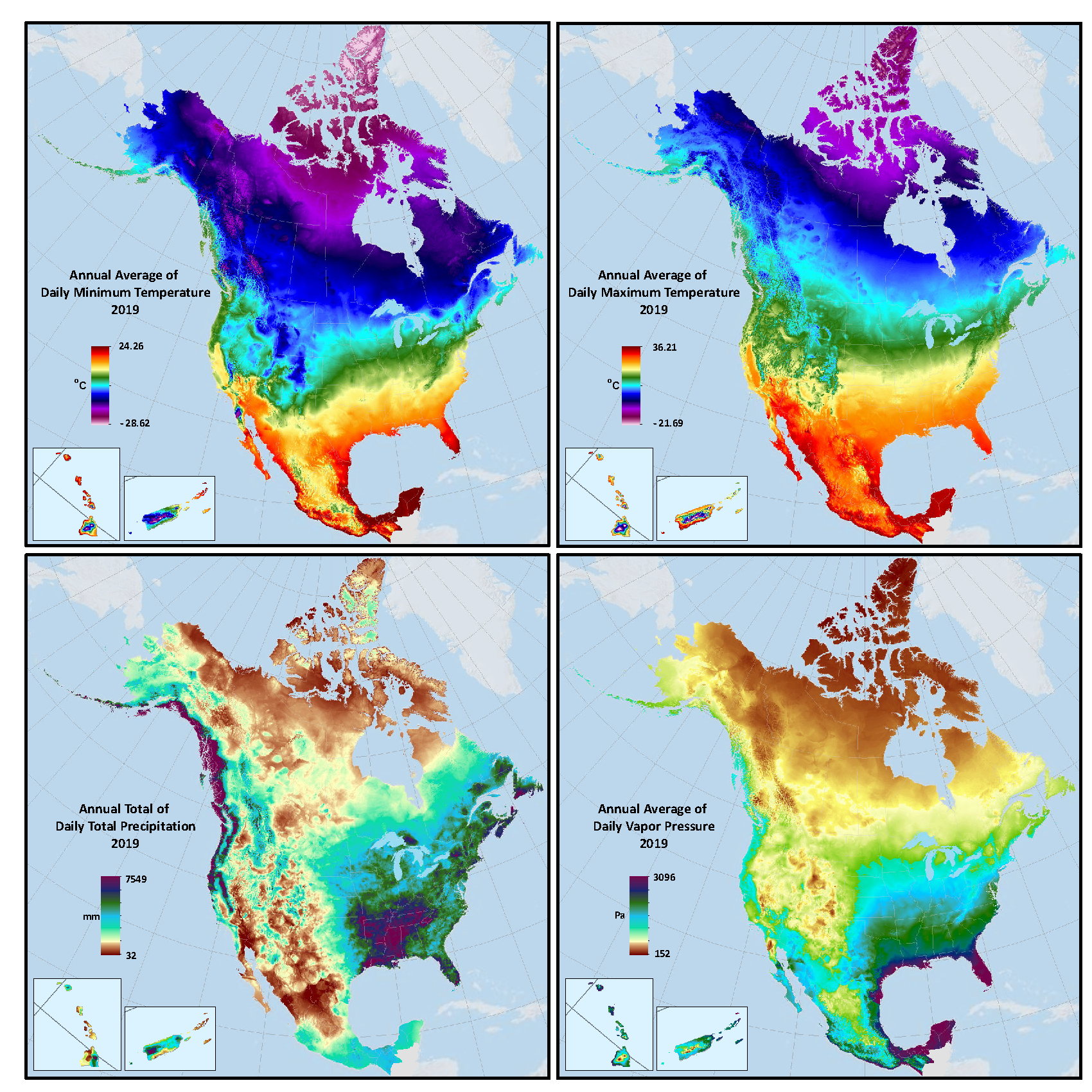
We use three-dimensional regression analysis to estimate horizontal and vertical gradients in daily maximum and minimum temperature, and in daily total precipitation. We use these relationships to interpolate observations between sparse observations and extrapolate to unsampled topographic domains. We also estimate radiation and humidity based on temperature and precipitation using well-tested climatological relationships. We explore and quantify the uncertainty in the gridded surface weather products so that users can easily assess data quality with respect to application-specific requirements. Our uncertainty analysis identified and corrected two significant biases associated with instrumentation and reporting of observations. The gridded surface weather data are being applied to drive the first-ever high-resolution offline E3SM Land Model simulations over North America. We distribute the dataset and uncertainty information through a capable multi-access interface developed and hosted by the ORNL DAAC.